Maps of the Holy Mosque and crowd management routes are a cornerstone of the operational plan adopted by the relevant authorities in the Kingdom of Saudi Arabia, most notably the General Presidency for the Affairs of the Two Holy Mosques, to ensure the smooth flow of crowds and the safety of pilgrims. This strategic guide is part of a comprehensive system aimed at facilitating the performance of rituals in a safe and tranquil spiritual atmosphere, especially during peak seasons such as the holy month of Ramadan and the Hajj season.
The importance of spatial planning and crowd management
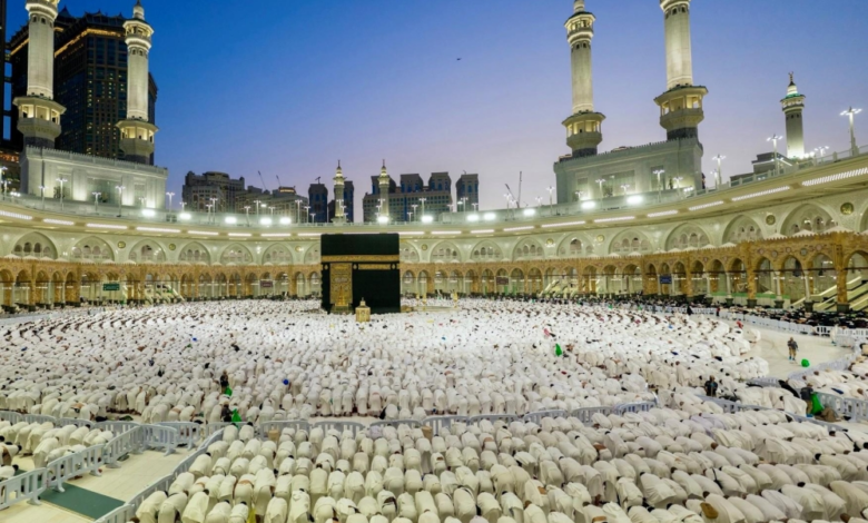
The importance of these maps extends beyond their role as mere guidance tools; they are the product of in-depth engineering and field studies that consider human density and the capacity of the circumambulation area, the Sa'i area, and the outer courtyards. The crowd management plans aim to distribute crowds evenly across the various gates of the Grand Mosque, allocating specific entry and exit routes. This effectively prevents overcrowding and stampedes, reflecting the Kingdom's commitment to implementing the highest international safety standards in managing millions of pilgrims.
Historical context and the Kingdom's Vision 2030
The Grand Mosque in Mecca has witnessed numerous expansions throughout history, but the Saudi era has been distinguished by an unprecedented qualitative leap in architecture and services. These modern strategies for managing routes and digital maps are aligned with the Kingdom's Vision 2030 , which aims to host 30 million Umrah pilgrims annually. To achieve this ambitious goal, relying solely on urban expansion is no longer sufficient; logistical and technological organization has become the cornerstone for managing these increasing numbers efficiently and effectively.
Technology in service of the pilgrims
With the digital transformation, the maps of the Holy Mosque have evolved from traditional directional signs to smart, interactive maps accessible via smartphones and apps like “Nusk.” These technologies allow pilgrims and worshippers to see available gates, the current crowding in the circumambulation area (Mataf), and the quickest routes to access services and restrooms. This data also helps security and regulatory authorities make real-time decisions to reroute traffic when needed, ensuring the smooth flow of movement.
Expected impact on the experience of Umrah and Hajj pilgrims
Adherence to the designated crowd management routes outlined in the strategic maps positively impacts the Hajj and Umrah experience, saving pilgrims time and effort and avoiding areas of severe congestion. It also facilitates the performance of rituals for the elderly and people with disabilities through dedicated pathways and strategically located electric vehicles. This strategic guide embodies the Kingdom's commitment to serving the Two Holy Mosques and harnessing all available human and material resources for the comfort of those visiting the Sacred House of God.