Saudi Arabia showcases its geospatial leadership at the Arab experts meeting in Tunisia
In a move reflecting its regional and international leadership in the data and surveying sector, the Kingdom of Saudi Arabia showcased its distinguished experience in measuring geospatial maturity during its chairmanship of the 13th meeting of the Arab Committee of UN Experts on Geospatial Information Management. This event underscores the Kingdom's prominent global position in the governance of geospatial data and its application to sustainable development.
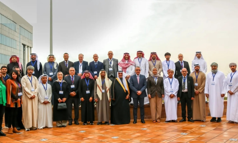
Saudi presidency and Arab and international presence in Tunisia
The meeting was held in Tunis, the capital of Tunisia, on February 3 and 4, with the Kingdom of Saudi Arabia, represented by the General Authority for Survey and Geospatial Information . The event saw broad participation from representatives of Arab states, relevant regional and international organizations, and representatives of the Secretariat of the United Nations Committee of Experts on Global Geospatial Information Management. This meeting comes within the framework of ongoing efforts to strengthen joint Arab cooperation in the field of geospatial infrastructure.
Meeting agenda: From governance to geodetic frameworks
The participants discussed a packed agenda of strategic topics, including a review of the Arab Committee's annual report and an examination of the contributions of the United Nations and international organizations to the development of this vital sector. The work of the specialized working groups was also highlighted
- Geodetic framework team.
- The Integrated Geospatial Information Framework team.
- Geospatial Governance Team.
These teams aim to unify standards and technical specifications to ensure data integration among Arab countries and support decision-making based on accurate and reliable information.
Inspiring national experiences: Saudi Arabia, Tunisia, and Iraq
The meeting witnessed an exchange of experiences and presentations of successful national practices. The Kingdom of Saudi Arabia presented its model for measuring geospatial maturity as a reference that could be utilized regionally. Similarly, the Republic of Tunisia gave a detailed presentation on its adoption of the Integrated Geospatial Information Framework, showcasing its National Geographic Information Infrastructure project and its training programs in this field. For its part, the Republic of Iraq shared its national plan for implementing the Integrated Framework, reflecting a growing interest among Arab states in developing their geospatial systems.
The importance of geospatial information in development
Geospatial information is of paramount importance in the modern era, serving as a cornerstone for urban planning, natural resource management, disaster response, and achieving sustainable development goals. During the meeting, the Kingdom emphasized the need to strengthen follow-up and coordination among Arab states and to implement the principles of geospatial governance to enhance the efficiency of information management, which directly contributes to supporting the digital economy and improving quality of life.