
مقدمة عن حالة الطقس في السعودية
تشهد المملكة العربية السعودية تنوعاً مناخياً فريداً يعكس اتساع مساحتها الجغرافية وتنوع تضاريسها. وفي هذا السياق، كشف المركز الوطني للأرصاد في تقريره التفصيلي عن حالة الطقس المتوقعة لهذا اليوم الثلاثاء، عن استمرار التقلبات الجوية التي تشمل هطول أمطار رعدية متفاوتة الغزارة، وجريان السيول، ونشاطاً ملحوظاً في الرياح السطحية المثيرة للأتربة والغبار على أجزاء واسعة من مناطق المملكة.
تفاصيل الحالة المطرية وتوزيعها الجغرافي
أوضح التقرير الصادر عن المركز الوطني للأرصاد أن الفرصة لا تزال مهيأة لهطول أمطار رعدية تتراوح شدتها بين المتوسطة والغزيرة. وتتركز هذه الحالة بشكل خاص على أجزاء من مناطق عسير، وجازان، ونجران، حيث يُتوقع أن تؤدي هذه الأمطار إلى جريان السيول في الأودية والشعاب، وتكون مصحوبة بزخات من البرد، مما يستدعي أخذ الحيطة والحذر من قبل قاطني تلك المناطق.
على صعيد آخر، يُتوقع أن تكون الأمطار خفيفة إلى متوسطة الشدة على أجزاء من مناطق الباحة، ومكة المكرمة، والعاصمة الرياض. كما أشار التقرير إلى أنه لا يُستبعد تكون السحب الرعدية الممطرة على أجزاء من مناطق الحدود الشمالية، والجوف، والقصيم، والمدينة المنورة، مما يضفي أجواءً غائمة وممطرة على مساحات شاسعة من البلاد.
تأثير الرياح النشطة والعواصف الترابية
وفيما يخص حركة الرياح، حذر المركز من استمرار تأثير الرياح السطحية النشطة المثيرة للأتربة والغبار على أجزاء من المناطق الشمالية والوسطى، بالإضافة إلى أجزاء من المنطقة الشرقية. وقد تصل شدة هذه الرياح إلى مستوى يؤدي إلى شبه انعدام في مدى الرؤية الأفقية، خاصة على أجزاء من مناطق شمال المملكة، مما يتطلب انتباهاً شديداً من قائدي المركبات على الطرق السريعة.
حالة الملاحة البحرية: البحر الأحمر والخليج العربي
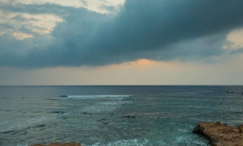
تضمن تقرير الأرصاد تفاصيل دقيقة حول حالة الملاحة البحرية. ففي البحر الأحمر، تكون الرياح السطحية شمالية غربية إلى شمالية بسرعة تتراوح بين 20 إلى 43 كم/ساعة على الجزأين الشمالي والأوسط، وبسرعة 15 إلى 30 كم/ساعة على الجزء الجنوبي. ويبلغ ارتفاع الموج من متر إلى مترين شمالاً ووسطاً، ومن نصف المتر إلى متر ونصف جنوباً، لتكون حالة البحر خفيفة إلى متوسطة الموج.
أما في الخليج العربي، فتشير التوقعات إلى أن الرياح السطحية ستكون شمالية غربية إلى شمالية بسرعة تتراوح بين 16 إلى 32 كم/ساعة. ويتراوح ارتفاع الموج بين نصف المتر إلى متر ونصف، لتستقر حالة البحر بين خفيف إلى متوسط الموج، مما يجعله مناسباً للأنشطة البحرية المعتادة مع توخي الحذر.
السياق التاريخي والمناخي للتقلبات الجوية
تاريخياً، تُعرف شبه الجزيرة العربية بتعرضها لموجات من التقلبات الجوية خلال الفترات الانتقالية بين الفصول. وتلعب التضاريس دوراً حاسماً في هذا التنوع؛ فالمرتفعات الجنوبية الغربية (مثل عسير وجازان) تستقبل كميات أعلى من الأمطار بفضل الرياح الموسمية وتأثير الجبال التي تجبر الهواء الرطب على الارتفاع والتكاثف. في المقابل، تُعد المناطق الشمالية والشرقية أكثر عرضة للرياح الهابطة والعواصف الرملية بسبب طبيعتها الصحراوية المنبسطة.
الأهمية والتأثير المتوقع محلياً وإقليمياً
تحمل هذه التغيرات الجوية أهمية كبرى على الصعيد المحلي. فمن الناحية الإيجابية، تساهم الأمطار في تعزيز المخزون المائي الجوفي، ودعم الغطاء النباتي والقطاع الزراعي، خاصة في المناطق الريفية. ومع ذلك، فإن جريان السيول وانعدام الرؤية بسبب الغبار يفرضان تحديات على البنية التحتية وحركة النقل البري والجوي. ولذلك، تعمل الجهات المعنية، وعلى رأسها المديرية العامة للدفاع المدني، بشكل دائم على إصدار التحذيرات الاستباقية وتوجيه المواطنين والمقيمين للابتعاد عن بطون الأودية ومجاري السيول، واتباع إرشادات السلامة المرورية أثناء العواصف الترابية، لضمان سلامة الأرواح والممتلكات.