In a strategic move aimed at reshaping the environmental landscape of Saudi Arabia, the National Afforestation Program unveiled an ambitious project to divide the Kingdom into 21 distinct plant regions. This announcement came during a comprehensive workshop held in Riyadh, the capital, which brought together leading experts and specialists to lay the foundation for a precise knowledge base to guide environmental planning and combat desertification efforts.
The context of the vision and the Saudi Green Initiative
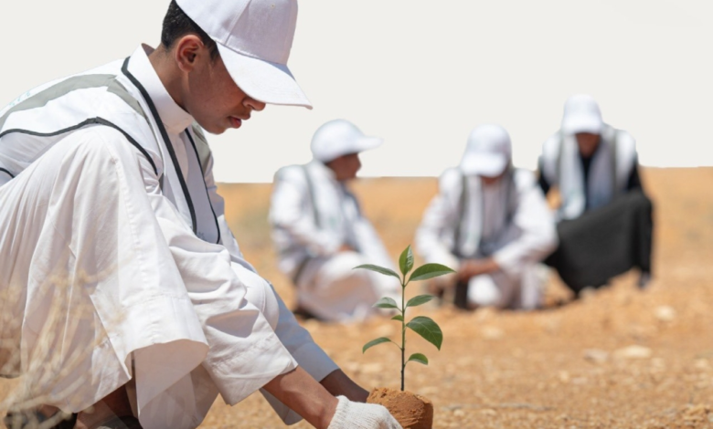
This well-considered scientific move comes at a time when the Kingdom is intensifying its efforts to achieve the goals of Saudi Vision 2030 and the Saudi Green Initiative, which aims to plant 10 billion trees over the coming decades. This initiative is one of the world's largest reforestation projects, targeting environmental challenges such as rising temperatures, deteriorating vegetation cover, and desertification. Accurately identifying plant regions is a crucial step to ensuring the success of this ambitious initiative, as it guarantees that trees are planted in their appropriate natural environments, thus reducing water waste and increasing seedling survival rates.
Regional Map: A Compass for Environmental Action
Engineer Ahmed Al-Ayadah, CEO of the National Center for Vegetation Development and Combating Desertification, affirmed that the new plant regions map is not merely a technical document, but a comprehensive strategic reference that outlines the Kingdom's environmental future. He explained that the project will enable researchers and planners to access accurate and documented data by electronically and directly linking the map to the National Afforestation Platform. This technical integration will make the platform the sole official channel for documenting and registering all trees intended for planting, thus ensuring that all entities adhere to the approved environmental standards.
A scientific methodology to ensure sustainability
The identification of the 21 plant regions was not arbitrary. The project relied on a complex scientific methodology that included a multi-layered analysis of climatic, spatial, soil, and biodiversity data. This theoretical analysis was reinforced by extensive fieldwork to validate the data and select accurately representative sites. This rigorous methodology aims to implement the principle of "the right tree in the right place," which will positively impact the management of rangelands and forests and the development of seedling production plans in local nurseries.
Expected impact: Quality of life and ecological balance
This project is expected to contribute to achieving a sustainable ecological balance and restoring degraded lands, directly impacting the quality of life and the overall environment for citizens and residents. Restoring vegetation cover based on scientific principles will help moderate the climate, reduce dust storms, and enhance the Kingdom's unique biodiversity. Furthermore, this project serves as a regional and international model for managing natural resources in arid and semi-arid regions, reinforcing the Kingdom's position as a leader in climate and environmental action.