The National Center for Meteorology, revealed details of Monday's weather conditions in Saudi Arabia, noting significant fluctuations including rainfall, a drop in temperatures, and active surface winds stirring up dust and sand. This weather pattern is typical of winter in the Kingdom, where different regions are affected by diverse air masses due to the country's vast geographical expanse.
Rainfall and cold wave map
The report indicated that the chance of thunderstorms accompanied by active winds that reduce horizontal visibility remains high in parts of the Al-Baha and Makkah , with this effect extending to the southern parts of the Madinah highlands. These mountainous areas (the Sarawat Mountains) are prone to the formation of cumulonimbus clouds due to their topography, which contributes to the lifting and condensation of moist air.
In contrast, the northern regions are experiencing different weather conditions, with cold to very cold conditions persisting in parts of Hail, Al-Jawf, and the Northern Borders regions . The influence of cold air masses extends to the northern parts of the Eastern Province. This is usually attributed to the influence of Siberian high-pressure systems or polar air masses that dominate the atmosphere during this time of year in northern Saudi Arabia.
Surface winds and reduced visibility
The report did not only mention the rain and cold weather, but the center also warned of the continued impact of active winds stirring up dust and sand. This impact includes:
- Parts of the Tabuk, Medina, and Mecca regions.
- The eastern parts of the southwestern highlands.
- Parts of the northern and eastern regions.
These winds may lead to near-zero horizontal visibility, which calls for caution and vigilance for those using highways and open roads.
Special alerts for the Eastern Province
The center issued a special alert for the Eastern Province regarding active winds and blowing dust starting at 9:00 AM and continuing until 6:00 PM. The effects include:
- The cities of Jubail, Dammam, Khobar, Qatif, and Ras Tanura: Winds reaching speeds of (40-49) km/h and reduced visibility.
- Al-Ahsa, Al-Udayd, and Buqayq: Dust storms that reduce visibility to (3-5) kilometers.
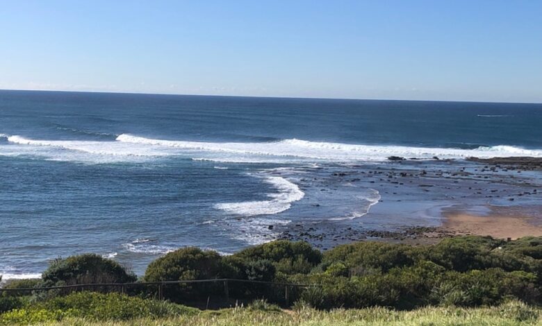
State of the Red Sea and the Arabian Gulf
In terms of maritime navigation, the Red Sea surface winds reaching speeds of up to 50 km/h in its central and southern parts, accompanied by thunderstorms, which are raising waves to more than two meters and creating rough sea conditions. As for the Arabian Gulf , winds are northwesterly to northeasterly at speeds of up to 40 km/h, with wave heights ranging from one to two meters.
The importance of following weather forecasts
These reports are of paramount importance to citizens and residents for planning their daily activities, especially given the Kingdom's diverse climate. These weather conditions directly impact land and sea navigation, necessitating everyone's adherence to safety guidelines issued by relevant authorities such as Civil Defense and Highway Patrol, particularly during rainfall or heavy dust storms.