Interactive maps of the Two Holy Mosques: A smart guide to 950 landmarks using 3D technology
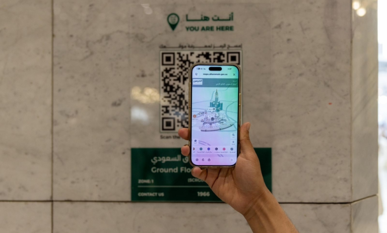
In a qualitative step that enhances the use of technology to serve those visiting the Sacred House of God and the Mosque of His Noble Messenger, the General Authority for the Care of the Affairs of the Grand Mosque and the Prophet’s Mosque the “Interactive Digital Maps” platform, which is an advanced guidance system that comes in conjunction with the millions of human densities that the Two Holy Mosques witness during the blessed month of Ramadan.
Digital transformation in serving the pilgrims
This launch comes within the framework of the Kingdom of Saudi Arabia's strategic direction towards digitizing services provided to pilgrims, in line with the objectives of Vision 2030 and the Guests of God Service Program. Crowd management no longer relies solely on human personnel and traditional signage, but has moved to an advanced level based on artificial intelligence and precise spatial data, to ensure a smooth and safe spiritual experience for millions from around the world.
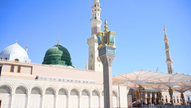
Extreme precision covering all parts of the Grand Mosque
The new platform represents a fundamental shift in the concept of spatial guidance , providing comprehensive and highly accurate coverage of the Grand Mosque's geographical area. Maps include:
- The Mataf and Sa'i areas, with all their levels.
- Various Saudi expansions and upper floors.
- The basement area and surrounding outdoor courtyards.
- Road network and pedestrian entrances leading to the sanctuary.
950 landmarks and service locations at the pilgrim's disposal , enabling immediate guidance to prayer areas, cart delivery centers, and safe deposit boxes, in addition to identifying the locations of elevators, escalators, and emergency exits, thus saving effort and time and reducing congestion in the corridors.
The Prophet's Mosque: Precise paths to the Noble Garden
In Medina, interactive maps offer smart solutions for visitors to the Prophet's Mosque, mapping precise routes to the Rawdah (the and his pulpit), covering the eastern and western expansions, the roof, and the parking areas. The platform also pays special attention to those most in need, clearly highlighting the locations of services for the elderly and people with disabilities, ensuring their easy and effortless access to all facilities.
Reality simulation and crowd management techniques
The platform goes beyond traditional two-dimensional maps, offering three-dimensional (3D) that simulate the actual environment, supported by color coding that matches existing signage. This technology plays a vital role in crowd management by:
- Providing real-time indicators of crowding and density in prayer rooms and corridors.
- Automatically suggesting alternative routes to avoid crowded areas.
- Mapping over a million safe transportation routes helps distribute human densities in a balanced way.
This technology is expected to contribute significantly to increasing operational efficiency during peak times in Ramadan and the Hajj season, reflecting the keenness of the concerned authorities to harness the latest global technologies to serve the pilgrims of the Two Holy Mosques.