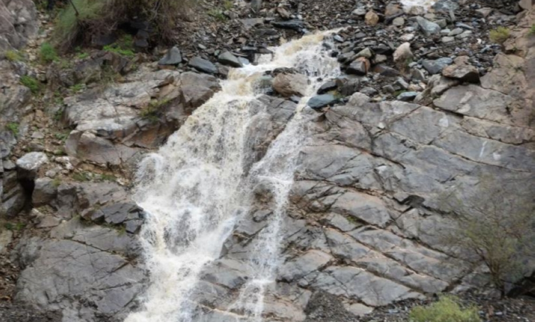
Abha leads the Kingdom's regions and records the highest rainfall rate at 36 mm
Introduction: Abha at the forefront of the climate scene
Saudi Arabia experienced positive and promising weather changes, with the Asir region recording the highest rainfall in the Kingdom. According to official data, 36.0 mm of rain fell in Wadi Dhahab, Abha Governorate. This figure is part of a comprehensive report covering eight administrative regions, reflecting a noticeable period of atmospheric activity that contributes to replenishing water resources and moderating the climate.
Details of rainfall amounts in the southern regions
The southern regions of the Kingdom are characterized by their abundant rainfall, and the daily report from the Ministry of Environment, Water and Agriculture showed varying amounts. In the Asir region, Al-Shifa neighborhood in Sarat Abidah recorded 35.6 mm, followed by Abha Airport with 34.5 mm, and then Al-Harjah with 33.8 mm. Al-Khalaf in Sarat Abidah recorded 27.2 mm, and Al-Tamam in Abha recorded 22.0 mm, while Tabab in Abha and Al-Asran in Sarat Abidah each recorded 16.8 mm, and Tamniyah in Abha recorded 15.4 mm.
In the Najran region, rainfall amounts reached 10.7 mm in Al-Khalidiyah, 3.0 mm at Sharurah Airport, 2.8 mm at Najran Airport, 2.5 mm in Najran city, and 1.1 mm in Al-Ukhdood. In Jazan, Al-Qur'ah recorded 6.4 mm in Al-Ardah and 3.0 mm in Al-Aydabi. In the Al-Baha region, Al-Baher recorded 1.2 mm, Baljurashi 1.0 mm, and Al-Jawwah in Al-Makhwah 0.6 mm.
Rainfall monitoring in the northern and central regions
Rainfall extended to the northern and central regions, with 74 hydrological and climatological monitoring stations belonging to the Ministry recording varying amounts over a 24-hour period. In the Tabuk region, Al-Zaytah recorded 14.6 mm, Al-Bada'a 10.2 mm, Al-Aqan 8.3 mm, Tadco Agricultural Company 5.6 mm, and Prince Sultan Road 2.0 mm.
In the Al-Jawf region, Al-Qurayyat recorded 4.5 mm of rainfall, Wa'lah in Tabarjal 2.8 mm, Ain Al-Hawas 2.5 mm, King Salman Reserve 2.3 mm, and Al-Qurayyat Airport 2.2 mm. In the Northern Borders region, Tarif Airport recorded 3.8 mm, Al-Jarani 1.7 mm, and Tarif city 1.3 mm. In the Riyadh region, Al-Badi' Al-Shamali in Al-Aflaj recorded 2.9 mm, and Wadi Al-Dawasir 0.6 mm.
The geographical and historical context of the climate of the Asir region
Historically, the Asir region, and specifically the city of Abha, is known as one of the wettest areas in the Arabian Peninsula. This is due to its high altitude, exceeding 2,200 meters above sea level, and its geographical location, which intercepts the humid monsoon winds coming from the Red Sea. This unique climate has contributed over the centuries to the formation of its famous agricultural terraces and the growth of dense juniper forests, making it a climatic and environmental exception in the region.
Importance and expected impact (locally and regionally)
This rainfall is of paramount importance on several levels. Locally , it plays a vital role in replenishing groundwater and surface dams, thus supporting the agricultural sector upon which many residents of the southern regions depend. Furthermore, this rainy weather revitalizes domestic tourism, as visitors and tourists flock to Abha and the surrounding areas to enjoy the stunning natural beauty and mild climate, escaping the summer heat of other regions.
At the national and regional levels , these favorable rainfall levels align with the goals and objectives of the Saudi Green Initiative, contributing to increased vegetation cover, combating desertification, and improving quality of life. Documenting this accurate data through monitoring stations enhances the Kingdom's ability to manage its water resources efficiently and develop strategic plans to ensure sustainable water security for future generations.