The National Center for Meteorology warns of unstable weather conditions
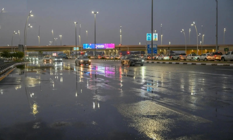
The National Center for Meteorology in Saudi Arabia issued its daily weather forecast for Friday, warning of continued weather fluctuations across most of the Kingdom. The forecast indicates moderate to heavy thunderstorms, potentially leading to flash floods, accompanied by hail, strong winds that may stir up dust and sand, and the possibility of fog in some areas.
Details of the areas affected by the rainfall
According to the center's statement, severe rainfall is expected to affect large parts of the Eastern Province, the Northern Borders region, Al-Jawf, Hail, Al-Qassim, Riyadh, Madinah, Makkah, Al-Baha, Asir, and Jazan. Rainfall in these areas will be moderate to heavy, increasing the likelihood of flash floods in valleys and low-lying areas. Light to moderate rain is also expected in parts of the Tabuk and Najran regions. The center also warned of the possibility of fog forming during the night and early morning hours in parts of these areas, which could reduce horizontal visibility.
Climate context and the importance of warnings
These weather fluctuations are part of a transitional climatic period in the Arabian Peninsula, known locally as the "Sarayat" or "Marawih" season. This period is typically characterized by atmospheric instability and the rapid formation of cumulonimbus clouds. The importance of these warnings lies in raising awareness among citizens and residents, especially those using highways and living near wadis (valleys). Relevant authorities, such as Civil Defense and Highway Patrol, are increasing their preparedness to respond to any emergencies that may arise from these weather conditions, in order to protect lives and property.
Expected impacts on daily life and navigation
This weather system is expected to affect land, sea, and air traffic. Active winds may reduce horizontal visibility on roads, while high waves and rough sea conditions will impact navigation in the Red Sea and the Arabian Gulf. Therefore, caution is advised, and the public is urged to follow the latest updates from the National Center of Meteorology and adhere to the instructions of the relevant authorities to ensure public safety.
Red Sea situation
- Surface winds: Northwesterly to northerly at 15-30 km/h in the northern and central parts, reaching 50 km/h towards the Gulf of Aqaba. Northwesterly to southwesterly at 10-22 km/h in the southern part.
- Wave height: from half a meter to one and a half meters in the northern and central parts, reaching two and a half meters towards the Gulf of Aqaba. From half a meter to one meter in the southern part.
- Sea state: Light to moderate waves in the northern and central parts, becoming rough towards the Gulf of Aqaba, and light waves in the southern part.
Arabian Gulf situation
- Surface winds: Northwesterly to northerly at a speed of 15-30 km/h, reaching more than 50 km/h with the formation of rain-bearing thunderclouds.
- Wave height: from half a meter to one and a half meters, reaching more than two meters with the formation of rain-bearing thunderclouds.
- Sea state: Light to moderate waves, becoming rough with the formation of rain-bearing thunderclouds.