Saudi Arabia weather forecast for Sunday: Thunderstorms and flash floods in 10 regions
Weather forecast for Saudi Arabia for Sunday
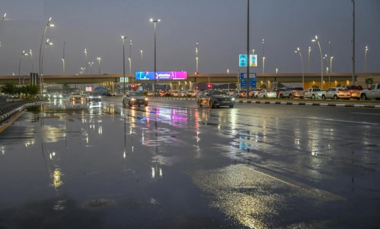
The National Center for Meteorology in Saudi Arabia issued its daily weather forecast for Sunday, warning of continued weather fluctuations across large parts of the country. The forecast indicates moderate to heavy thunderstorms, accompanied by strong winds that will stir up dust and sand, potentially leading to near-zero visibility in 10 different regions.
According to the center's statement, the affected areas include the Eastern Province, the Northern Borders, Hail, Qassim, Riyadh, Madinah, Makkah, Al-Baha, Asir, and Jazan. Heavy rainfall is expected to cause flash floods in valleys and ravines, and may be accompanied by hail in some areas. Furthermore, the center does not rule out the possibility of fog forming during the night and early morning hours in parts of these regions, making it even more important to take precautions.
Climate context and the importance of warnings
This weather pattern occurs during a transitional period in the Kingdom's atmosphere, known locally as the "Sarayat" or "Marawih" season, a period typically characterized by rapid and sharp weather fluctuations. This period is distinguished by the sudden formation of cumulonimbus clouds, particularly during the afternoon, due to surface heating and the availability of moisture in the upper atmosphere. The Kingdom's diverse topography, from the mountainous highlands of the southwest to the vast deserts of the central and northern regions, plays a significant role in determining the intensity and distribution of these weather phenomena.
The importance of these warnings lies in maintaining public safety, as relevant authorities, such as the General Directorate of Civil Defense, base their plans and directives on reports from the National Center for Meteorology. Citizens and residents are advised to stay away from floodplains and valleys, exercise caution while driving, and continuously monitor official weather forecasts for the latest updates.
Expected impacts on different sectors
The impact of this weather system extends beyond public safety to other vital sectors. In agriculture, these rains are a crucial source for replenishing groundwater levels and dams, thus benefiting farmers. However, the heavy rain and hail could also damage some crops. As for maritime navigation, the strong winds and high waves in the Red Sea and the Arabian Gulf necessitate caution from fishermen and small boat owners.
Red Sea situation
- Surface winds: Northwesterly to westerly at a speed of 10-28 km/h on the northern and central parts, and southeasterly to southerly on the southern part at a speed of 12-40 km/h, which may reach 50 km/h towards the Bab al-Mandab Strait.
- Wave height: from half a meter to one meter on the northern and central parts, and from one meter to two meters on the southern part, and may reach two and a half meters towards the strait.
- Sea conditions: Light waves in the northern and central parts, moderate waves in the southern part, and may be rough towards the strait.
Arabian Gulf situation
- Surface winds: Northwesterly to northeasterly at a speed of 10-32 km/h in the northern part, and northerly to northeasterly at a speed of 15-45 km/h in the central and southern parts, possibly reaching more than 50 km/h with the formation of rain-bearing thunderclouds.
- Wave height: from half a meter to one and a half meters on the northern part, and from one meter to two meters on the central and southern parts, and may reach more than two meters with the formation of thunderclouds.
- Sea state: Light to moderate waves in the northern part, and moderate waves that may be rough in the central and southern parts with the formation of thunderclouds.