Weather forecast for Saudi Arabia for Sunday
Amid ongoing monitoring of weather fluctuations, the National Center for Meteorology in Saudi Arabia announced details of weather conditions for Sunday. Forecasts indicate continued atmospheric instability across large parts of the Kingdom, with significant warnings issued for thunderstorms, flash floods, and hail showers in parts of 10 different administrative regions.
General and historical context of weather fluctuations in the Kingdom
These climatic changes occur within the context of transitional periods in the Arabian Peninsula, which are typically characterized by sharp weather fluctuations. Historically, the southwestern highlands of the Kingdom, such as the Asir and Jazan mountains, have been known to receive significantly more rainfall than other regions, a result of the interaction of monsoon winds and the complex mountainous terrain. This rainfall plays a vital role in replenishing groundwater and supporting the local agricultural sector, but it also requires careful management due to the geographical features that enhance the speed of flash floods in valleys and ravines.
Rain and wind map details
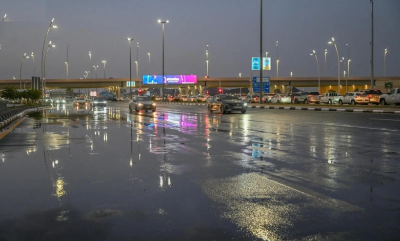
According to the official statement issued by the National Center for Meteorology, there remains a chance of moderate to heavy rainfall. This rainfall may lead to flash floods and be accompanied by hail and strong downdrafts in parts of the Asir, Jazan, and Najran.
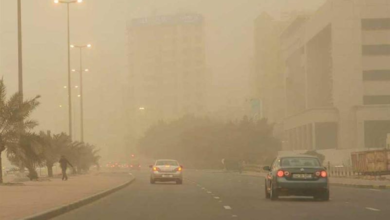
Meanwhile, light to moderate rain is expected in parts of the Eastern Province, the Northern Borders region, Al-Jawf, Hail, Al-Qassim, Riyadh, and Al-Baha. At the same time, active winds will continue to stir up dust and sand, potentially reducing horizontal visibility in parts of these regions, as well as in parts of Tabuk, Madinah, and Makkah, particularly along their coastal areas. Temperatures are also expected to drop noticeably in the northern parts of the Kingdom.
Expected impact on maritime navigation and public life
This weather has direct impacts on daily activities and maritime navigation. Locally, authorities consistently urge caution and advise staying away from wadis and water bodies to ensure public safety. Regarding maritime affairs, the report details the situation at ports and along the coast as follows:
Red Sea situation
- Surface winds: Northwesterly to northerly winds will blow at speeds of 30 to 55 km/h over the northern and central parts, and at speeds of 15 to 35 km/h over the southern part.
- Wave height: ranging from one and a half to three meters on the northern and central parts, and from half a meter to one and a half meters on the southern part.
- Sea conditions: The sea will be moderate to rough in the northern and central parts, and light to moderate in the southern part, which calls for caution from fishermen and sea-goers.
Arabian Gulf situation
- Surface winds: Northwesterly to northerly at a speed of 16 to 33 km/h, and may reach a speed of 45 km/h with the formation of rain-bearing thunderclouds over the northern and central parts.
- Wave height: from half a meter to one and a half meters, and may reach more than two meters in the event of thunderstorms.
- Sea state: Light to moderate waves, becoming rough with rainy thunderstorms.
In conclusion, these accurate forecasts reflect the great efforts made by the Kingdom in the field of meteorology and early warning, which contributes to protecting lives and property, and enhances the readiness of the infrastructure to deal with various climatic conditions.