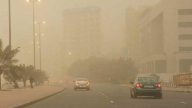
An expert told Al-Youm: Floods are a renewable water resource that requires a precise measurement system
In this context, Dr. Raed Al-Harbi, Associate Professor of Water Resources Engineering at King Saud University, confirmed to Al-Youm that floods are not just a passing seasonal phenomenon, but represent a renewable water resource with developmental value if it is properly understood and managed. He pointed out that the main challenge does not lie in the existence of floods, but in the ability to measure them and convert them into accurate data that can be used in planning.
Water resource renewal
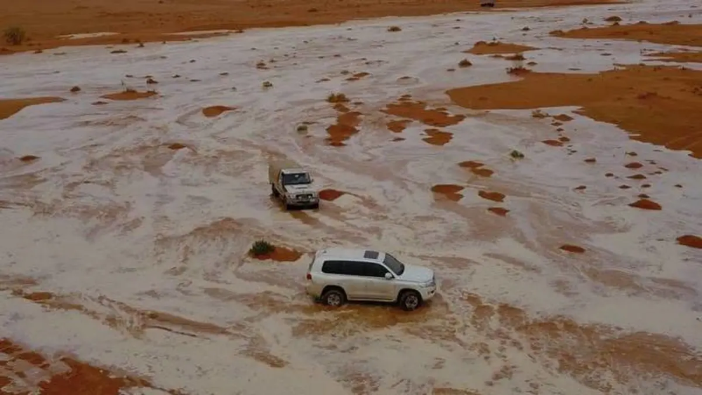
He explained that rainfall is the primary source of replenishment of renewable water resources in the Kingdom. Despite its fluctuations and concentration over short periods, it contributes to the formation of flash floods that flow through valleys and ravines. It is a resource that can be utilized for both water management and development, but at the same time, it can become a hazard if integrated management is lacking.
He added that flash floods contribute to supporting water resources through two main channels: first, by replenishing renewable groundwater reservoirs through seepage into the ground, and second, by harvesting it through dams and rainwater storage facilities.
He indicated that hydrological estimates suggest that the average annual volume of flash floods in the Kingdom is approximately 8 billion cubic meters, of which about 60% can be utilized. However, these figures remain general estimates and do not always reflect the specific realities of each rainfall event.
He pointed out a clear gap between estimates and measurements, explaining that current field observations regarding the strength and width of flash floods suggest large quantities of water. However, the lack of direct field measurements of water levels and flow velocities makes it difficult to convert these observations into accurate and reliable data for water planning.

Dr. Raed Al-Harbi
He stressed that field measurement represents the scientific basis for building hydrological and hydraulic models, which in turn are a key tool in understanding the behavior of flash floods and accurately estimating their quantities, in addition to using them to assess opportunities for water harvesting, support plans for replenishing renewable groundwater reservoirs, and simulate the movement of flash floods within valleys according to different rainfall scenarios.
Maximizing the benefits of floods
He explained that the relationship between rainfall and flash floods is not direct, as it is influenced by several factors such as the characteristics of watersheds, soil type, slope, land use, and other factors. This makes relying solely on rainfall data insufficient for understanding the actual hydrological response and underscores the need for direct measurement of surface flows.
He pointed out that hydrological and hydraulic studies play a crucial role in urban planning by identifying the paths of valleys and ravines and directing development away from them. Furthermore, they are essential for designing flood drainage networks and their channels in accordance with the natural behavior of watersheds, thus contributing to reducing risks and losses, especially with the increasing intensity of certain rainfall events.
He pointed out that some floodwater is lost due to its flow towards coastal areas or open areas with high evaporation rates. This makes advance planning essential to maximize its utilization before it is lost, transforming it from a potential threat into a water resource that supports water security.
He added that understanding the flow patterns of wadis is a fundamental element in managing this resource. Some wadis end up in the sea, resulting in the loss of significant quantities of water without utilization, while others flow towards desert areas where evaporation rates are even higher. This underscores the need for more precise monitoring of floodwater movement and its paths.
Reducing reliance on groundwater
He affirmed that the state has given increasing attention to floodwater within the objectives of the National Water Strategy, which aims to reduce reliance on non-renewable groundwater and maximize the utilization of renewable resources, including floodwater, through expanding dam projects, rainwater harvesting, and regulating wadi courses.
He also noted that the cloud seeding program is one of the initiatives supporting the enhancement of water resources. However, any increase in the resulting rainfall necessitates, in turn, greater emphasis on developing flood measurement systems and improving the accuracy of their calculations to ensure optimal utilization of the resulting water.
He stressed that calculating flood volumes is not limited to risk assessment but is a fundamental planning tool in the water, agricultural, and urban sectors. It is linked to early warning and risk management systems, thus contributing to informed decision-making.
He emphasized the importance of establishing an integrated national flood monitoring system based on field measurements, modeling, and early warning, while standardizing data and making it available to research institutions and universities. This will contribute to improving the efficiency of water planning and transforming floods from a seasonal challenge into a sustainable development opportunity for renewable water resources in the Kingdom.